
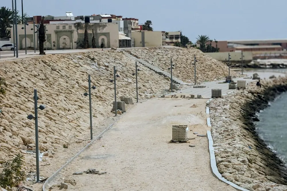
Coastal operating contexts refer to the specific environmental, geological, and biological conditions that define a shoreline area. These contexts encompass factors such as sediment transport, wave energy, and the forces that shape coastal systems. Understanding these variables is necessary for planning engineering projects, managing natural hazards, and protecting marine resources against sea-level rise and climate-driven changes.
For those managing shoreline equipment or infrastructure, these contexts dictate hardware selection. High-energy surf zones require different mooring and winch configurations than sheltered estuaries. By analyzing local bathymetry and seasonal storm patterns, operators can ensure that mechanical systems remain functional under extreme stress and corrosive saltwater exposure. The coastal zone is…
Key Drivers: Morphology, Sediment, and Ecosystems
In practice, the shoreline context assessment process works through a clear workflow: teams start by mapping each step, then walk through how the system works when conditions change. Using this step-by-step process, you can see when to act, what happens before and after each decision, and how outcomes flow through the platform or program.
The morphology, or physical shape, of a coastline is a primary driver of how water interacts with the land. Steep underwater profiles often lead to plunging breakers that deliver immense force directly to the shore, whereas gradual slopes dissipate energy through spilling waves. This physical layout determines the placement of boat ramps, piers, and heavy-duty winching stations. If the morphology includes a narrow continental shelf, the impact of deep-water swells is much more pronounced.
Sediment transport is another critical factor. Shorelines are governed by a sediment budget; if the volume of sand or silt leaving an area via longshore drift exceeds the volume arriving, erosion occurs. Coastal operators must understand these patterns before installing permanent structures. A jetty built to protect a small marina might inadvertently starve a downstream beach of sand, leading to structural instability in nearby coastal defenses. In 2026, many projects now prioritize "soft engineering" that works with these sediment flows rather than blocking them entirely.
Ecosystems like mangroves, salt marshes, and coral reefs act as biological buffers. These natural features reduce wave height and trap sediment, providing a first line of defense against storm surges. For instance, in the Gulf Coast regions, the preservation of salt marshes is often more effective for long-term shoreline stability than the construction of concrete bulkheads. Operators must evaluate how their mechanical interventions, such as dredging or cable laying, might disrupt these fragile biological contexts.
Managing Hazards and Shoreline Development
Coastal hazards, including chronic erosion and acute storm events, pose significant risks to human development. Effective management requires a move away from reactive repairs toward proactive, context-aware planning. This involves exploring the foundations of coastal infrastructure to determine if a site can support heavy loads or if it is prone to liquefaction during seismic events or severe flooding.
In areas prone to high-frequency storm surges, such as the Atlantic seaboard, development must account for the "100-year flood" levels, which are being recalibrated as sea levels rise. A practical example is the design of slipway winches. In a high-hazard zone, these systems are often mounted on elevated platforms or designed with quick-release mechanisms to allow for the rapid evacuation of vessels before a storm arrives. Understanding the hazard context ensures that the machinery does not become a liability or a source of debris during an extreme weather event.
Educational Frameworks and Instructor Resources
Teaching coastal literacy requires a multidisciplinary approach that combines geology, oceanography, and civil engineering. Educational frameworks often use case studies to illustrate how different operating contexts require different management strategies. For example, an instructor might compare the deltaic subsidence of the Mississippi River with the tectonic uplift seen along parts of the Pacific Northwest coast. These real-world scenarios help students understand why a "one size fits all" approach to coastal engineering is impossible.
Resources for instructors often focus on the "InTeGrate" model, which emphasizes the intersection of geoscience and societal challenges. By using these frameworks, students learn to calculate wave force, predict sediment movement, and assess the economic impact of shoreline loss. This level of literacy is essential for the next generation of maritime professionals who will be responsible for maintaining the mechanical and structural integrity of our ports and harbors.
Accessing and Reusing InTeGrate Materials
InTeGrate materials are community-developed resources designed to be flexible and adaptable for various educational settings. These materials are often licensed under Creative Commons, allowing maritime training centers and universities to integrate specific modules into their curricula. For a technical college focusing on marine mechanics, this might mean extracting data on saltwater corrosion rates to teach students about the maintenance cycles of industrial winches and galvanized steel components.
Accessing these materials typically involves using centralized repositories where peer-reviewed modules are stored. The goal of reusing these materials is to ensure that coastal management training is grounded in the latest scientific data. For example, a module on coastal hazards can be updated with 2026 sea-level projections, providing students with the most current information for their future roles in shoreline project management. This collaborative approach ensures that even small training facilities have access to high-level research.
First steps for shoreline context checks
Begin a site review with this short process before ordering winches or anchors.
- Start by classifying wave energy (sheltered estuary vs exposed surf zone).
- First step: map sediment transport direction from recent aerial photos.
- To begin fieldwork, log tide range and storm fetch for a full spring-neap cycle.
- Follow these steps with your crew: match mooring rating to peak load, then document assumptions.
- Schedule a quarterly revisit after major storms to update your context file.
Marine-Grade Equipment for Shoreline Projects
Practical operations along the coast require equipment that can withstand the unique stressors of the marine environment. When selecting winches for shoreline projects, operators must prioritize corrosion resistance and load capacity. Saltwater is highly conductive and chemically aggressive; therefore, hardware should ideally feature marine-grade stainless steel or specialized coatings. Electric winches used in these environments require high Ingress Protection (IP) ratings, such as IP67 or IP68, to prevent water from reaching the internal motors during high tides or heavy spray.
The choice between synthetic ropes and steel cables is also context-dependent. While steel is traditional, synthetic fibers like Dyneema offer a high strength-to-weight ratio and do not corrode. In a coastal context where equipment might sit idle in salt air for long periods, synthetic lines often provide better longevity and safer handling. Understanding the specific forces at play—such as the snatch loads caused by wave action on a moored vessel—allows operators to size their winches and lines appropriately to avoid catastrophic failure.
At Winches Club, we focus on bridging the gap between theoretical coastal science and the practical application of mechanical systems. By understanding the broader operating context of a shoreline, from sediment transport to wave energy, operators can make more informed decisions about the tools they use. Whether you are managing a small private slipway or a large-scale coastal defense project, aligning your equipment choices with the environmental realities of the site is the key to operational success and long-term durability.